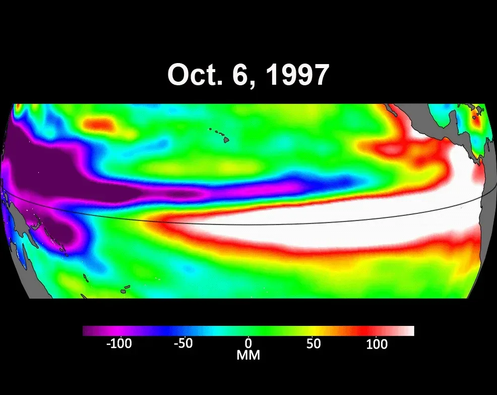
NASA is monitoring the 2026 El Niño in the equatorial Pacific with its Earth-observing satellites. In October, the National Oceanic and Atmospheric Administration (NOAA) put the chance that the strongest El Niño since 1950 is underway at 83%.
El Niño is a natural climate pattern in which waters in parts of the equatorial Pacific become warmer than normal. It can weaken or reverse trade winds, redistribute ocean heat, alter rainfall patterns and raise sea levels in parts of the Pacific.
One early sign appeared in satellite images in January 2026, when a Kelvin wave was detected near Micronesia in the western Pacific. By early April, Kelvin waves had reached the eastern Pacific and sea surface temperatures had begun to rise. In some areas, expanding warm water lifted sea levels by 30 to 40 centimeters; around Indonesia and northern Australia, levels were 15 to 20 centimeters below normal.
NASA says sea surface temperatures in the eastern Pacific are about 1.7 degrees Celsius above the long-term average. Josh Willis, project scientist for sea level missions at NASA’s Jet Propulsion Laboratory in California, described Kelvin waves as the “heartbeat of El Niño.”
Satellites can measure heat at the ocean surface through and around clouds. In 2026, observations mapped a band of warmer-than-normal water stretching from the central Pacific to the coast of South America. Heat and moisture carried from the ocean into the atmosphere can affect rainfall and weather patterns around the world.
El Niño also changes ocean color. NASA’s PACE satellite has detected that equatorial Pacific waters have become measurably bluer in recent months. The green-hued area in the western Pacific, typically associated with abundant phytoplankton, has shrunk.
When trade winds weaken, less nutrient-rich deep water rises to the surface. This can reduce phytoplankton and affect the wider marine food web. NASA scientists will continue to monitor the signs and impacts of El Niño with satellites.